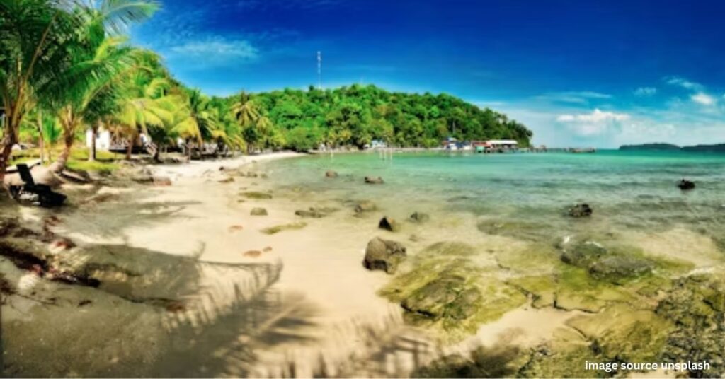
Whenever we plan to visit a new place, the first question we ask is, “Where to go and how to get there?” In a beautiful country like Cambodia, where there are countless beaches, traveling without the right information can be a bit challenging. That’s why today I’ve brought you a complete guide. Cambodia best beaches map A guide that will help you easily understand where each Cambodian beach is located and how to get there.
I remember the first time I visited Cambodia, I wasted a lot of time figuring out the map. Whether to go from Sihanoukville to Koh Rong or Koh Tonsay, how far to Kep, which island was closer—I struggled to find answers to all these questions. So I thought I’d make this journey a little easier for you.
Table of Contents
Understand Cambodia coastal geography
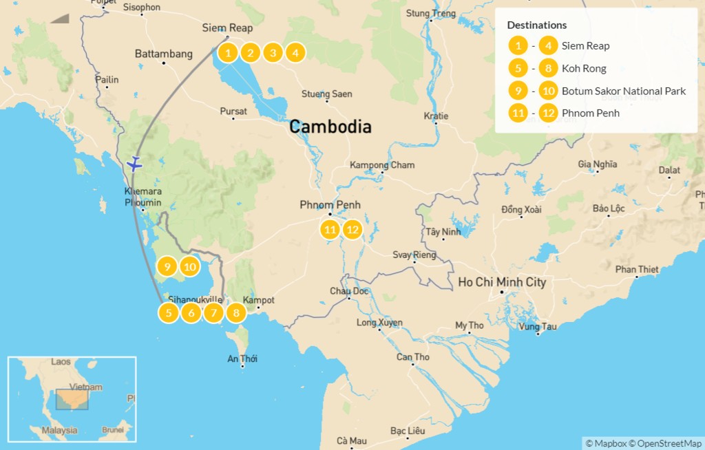
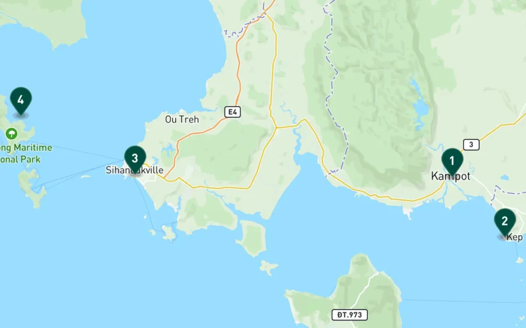
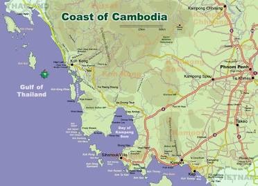
Cambodia’s entire coastline runs southwest along the Gulf of Thailand. This coastal strip is divided primarily into two provinces: Sihanoukville Province and Kep Province. Cambodia best beaches map If you look closely, you’ll find that most of the popular beaches and islands are concentrated around Sihanoukville town, while Kep sits as a secluded, quieter area near the Vietnam border.
Understanding this geographical location is important because it helps you plan your trip. For example, if you plan to spend more time on the islands, Sihanoukville should be your base camp.
Sihanoukville: Main Entrance
The first place that appears on the map is Sihanoukville. This city is the centerpiece of Cambodia’s coastal tourism. Sihanoukville is approximately 230 kilometers from the capital, Phnom Penh, and can be covered by road in approximately 4 to 5 hours. It also has an international airport with direct flight connectivity.
Within Sihanoukville itself, you’ll find places like Circle Beach, Otres Beach, and Independence Beach, all located just minutes from the city center, which is why most travelers start their trip here.
Distance to the islands and how to reach them

Now let’s talk about the most beautiful part of Cambodia: its islands. If you look at the map, you’ll find numerous small and large islands scattered in the sea just a few kilometers off the coast of Sihanoukville.
Koh Rong
Koh Rong is approximately 25-30 kilometers from Sihanoukville Port. The most common way to reach Koh Rong is by speedboat ferry, which takes approximately 45 minutes to 1 hour. The island is famous for its long beaches and vibrant nightlife.
Koh Rong Samloem
A little further from Koh Rong, but equally beautiful, is Koh Rong Saloem. This island is perfect for those who love peace and quiet. It takes about 45-60 minutes to reach it by ferry.
Koh Ta Kiev and Koh Rusey
If you’re looking for a quieter, less developed island away from the crowds, Koh Tonsay and Koh Ruessei are a must-see on the map. They’re close to Sihanoukville and make perfect day trip options.
Kep and Kampot: Quieter Alternatives
If you’re looking for a different experience away from the crowds, head to Kep and Kampot, located about 100 kilometers southeast of Sihanoukville. This area is close to the Vietnam border and is known for its tranquility, fresh seafood, and beautiful natural scenery.
The beaches in Kep aren’t as dazzlingly white as those in Koh Rong, but the atmosphere is incredibly relaxing. Kep is approximately 170 kilometers from Phnom Penh, a 3-4 hour road journey.
Read More: Mattupetty Dam: Where Mountains Meet the Clouds
How to plan the right travel route
If you’re traveling through Cambodia for the first time, here’s a simple route suggestion:
- Start in Phnom Penh– If you are visiting Angkor Wat or the capital, take a bus or shared taxi from there to Sihanoukville.
- 1-2 days stay in Sihanoukville– Explore the main beaches here and prepare for your trip to the next island.
- Visit Koh Rong or Koh Rong Saloem– Spend 2-3 days here and enjoy the real beach life.
- Return to the Cape– If you have time, definitely visit the Cape for its peaceful atmosphere.
Read More: Cambodia Best Beaches for Swimming
This route not only saves time but also gives you the opportunity to see different shades of Cambodia – vibrant nightlife on one side and peaceful tranquility on the other.
Things to keep in mind when using the map
- Keep the weather in mind:Some ferry services may be closed during the rainy season (May to October), so be sure to check the weather along with a map before traveling.
- Download offline maps:Internet connectivity is weak on many islands, so download the offline version of Google Maps in advance.
- Check ferry timings in advance:Ferries between the islands run on limited schedules, so carry a map as well as a timetable.
- Get help from a local travel agent:If you have trouble understanding the map, booking and route information can also be obtained from local travel agents in Sihanoukville.
Read More: Cambodia Beaches and Nightlife
conclusion
Cambodia’s beaches are not only beautiful but also easily connected, all you need is the right information.Cambodia best beaches mapThrough this guide, I’ve tried to explain the distances to each important destination, how to get there, and the correct travel order. Whether you’re a fan of vibrant nightlife or looking for quiet, secluded beaches, this Cambodia coastline map will make your next trip a breeze and memorable. Just pack your bags, grab a map, and set off on this beautiful journey.